Got something to say or just want fewer pesky ads? Join us... 😊

[Misc] The Award-winning official "More Snow Tomorrow?" Thread [2024-25 Season]


Cypriot-Seagull

Well-known member
Jul 15, 2011
1,153
Somewhere in Cyprus
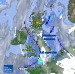
Fridays forecast
Hope it won't affect the game on Sat.
 

Attachments

  • 08.02.13.jpg
    08.02.13.jpg
    147.2 KB · Views: 275


Papa Lazarou

Living in a De Zerbi wonderland
Jul 7, 2003
19,358
Worthing
Worth re-posting this

Model Output Discussion 3-2-13 >>> - Page 16 - Weather - TheWeatherOutlook - TheWeatherOutlook discussion forum


Good morning all. Here's this morning's review of the 00z output from the big four namely GFS, UKMO, GEM and ECM for this morning Tuesday february 5th 2013.


All models show a very cold West to Northwest airflow over the UK veering Northerly over the coming 24 hours as a deep Low pressure slides South down the North Sea and away into Europe. Frequent wintry showers of rain and sleet, with hill snow in the South and sleet and snow in the North will continue through today giving some accumulations in the North. As winds veer Northerly the emphasis of showers will shift towards the East and West Coasts with many inland areas becoming cold and clear by night with a frost with compensatory bright and sunny days. Temperatures will remain below normal over the next couple of days but at least winds will decrease by Thursday. Later in the week troughs will move into the cold air and bring some outbreaks of rain or sleet and hill snow as they weaken in situ over the UK. Then the weather looks like becoming cold and dry over Saturday under a weak ridge of High pressure.


GFS then shows High pressure over Northern Scandinavia acting as a block to milder Atlantic winds pushing in from the West with the result that attempting troughs disrupt and slide SE over the UK on repeated occasions next week. The result would be rain and sleet moving into the West at times through the week with some snow possible in the colder air further East, especially on Monday when something a little more coherent is possible on the back edge of Low pressure exxiting Southeast from the South. In FI today the pattern remains in situ with further pushes of Atlantic air into the UK disrupting and sliding away SE with spells of rain, sleet or snow for all in rather cold conditions away from the far SW.


The GFS Ensembles are much more solid in agreement of rather cold conditions for the UK today with tight agreement on uppers being on the low side of normal throughout. With precipitation spikes shown no doubt snow would feature on many days somewhere or another.


The Jet Stream shows the basic pattern of a ridging of the flow over the Atlantic and down over the UK towards Southern Europe remaining in place over the coming week or so with a temporary weakening and breaking up of the flow at the weekend.


UKMO for next weekend shows a weak ridge of High pressure moving SE over the UK on Saturday followed by a fall of pressure in association with a disrupting but developing Low pressure area moving SE over the UK through Sunday and Monday with rain or snow for all later in the period with the chance of significant snowfall over the hills of the South early next week.


GEM shows a similar picture at Day 6 with rain and snow a feature especially in the South early next week before the model flattens the pattern with the Atlantic steaming back in with ease to bring rain and milder air across the UK from the West by the end of its run.


ECM too shows the same Low pressure and a snowy and very cold start to next week, especially in the South before a ridge quickly replaces the cold easterly flow on the back of the snowy Low bringing drier and frosty conditions before it too shows another attempt to bring milder air in off the Atlantic with some success in the NW where rain at times would develop while the South holds on to the cold under a tenuous ridge of High pressure.


In Summary today things are tidying up between the models on the mid term events covering the start of next week. All models now show something of a major Low slipping SE bringing the potential for some significant snow in places to start next week. The South looks likely to be most at risk though the North would see some too while the SW could see some rain or sleet rather than snow. Longer term GFS keeps the pattern of disrupting Low pressure sliding SE over the UK with a similar event to next Monday's showing up again in the operational at the end of FI while ECM and more especially GEM cut off the cold East flow that develops behind next weeks Low and find a way to get the Atlantic back into at least the NW by the middle of next week or so.
 
Last edited:


Papa Lazarou

Living in a De Zerbi wonderland
Jul 7, 2003
19,358
Worthing
FFS Papa,

Is it going to snow or what?


All I can say at the moment is it might. To be fair we might all see some later today (in the form of showers) - but it isn't likely to settle.


Papa Lazarou

Living in a De Zerbi wonderland
Jul 7, 2003
19,358
Worthing
absolutely...In the same way sense that Ryan Harley COULD have been a good player.

HHmm - I'd say it's about 50% chance of snow early next week - how does that compare to Mr Harley's chances?


Albion and Premier League latest from Sky Sports


Top
Link Here