Got something to say or just want fewer pesky ads? Join us... 😊

[Misc] The Award-winning official "More Snow Tomorrow?" Thread [2024-25 Season]


Muhammed - I’m hard - Bruce Lee

You can't change fighters
NSC Patron
Jul 25, 2005
10,895
on a pig farm
Thank god this rain wasn't snow thou, how much would the rainfall convert too Papa, could we be talking feet???


It depends upon the temp and other factors but it will range from 1 inch rain = 1 inch snow (Very wet slushy snow) to
1 inch rain = 13 inches of snow (Very fine dry powdery snow ).


i think :smile:


Flex Your Head

Well-known member
I am sooo sick of this wet, windy, mild weather. I looked for signs of something colder or drier on the Met Office website:

UK Outlook for Thursday 10 Jan 2013 to Thursday 24 Jan 2013:
Rather unsettled weather is likely to persist during the first half of January, with further spells of wet and windy weather across some areas. Despite this, southern areas may experience longer spells of drier conditions with more in the way of brightness and lighter winds. Temperatures are likely to often be close to or perhaps a little above average. Later in this forecast period, there is greater than average uncertainty, though some marked changes of weather-type are possible and the risk of spells of colder than average conditions increases.

Drier and brighter is to be welcomed, but that bit in bold at the end is so cryptic as to be entirely pointless.


Papa Lazarou

Living in a De Zerbi wonderland
Jul 7, 2003
19,185
Worthing
It's now looking like late next week (Jan 3rd onwards) that we might see a break in the Atlantic dominated weather, with High Pressure building from the SW. It may well be quite a cloudy affair, and fog will be a problem, but it will be much drier, and there's the potential for frost if the skies clear. The Met Office long range text above seems to suggest that their un-published LRF data is hinting at a change, whereas GFS shows nothing of the sort.

Meteociel - Diagrammes GEFS
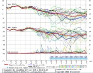

The Temp plot for Worthing shows it's going to be 'average' at best.

Meteociel - Diagrammes GEFS


severnside gull

Well-known member
May 16, 2007
24,762
By the seaside in West Somerset
Snow aside, is tomorrow's game at risk from the weather?
Pompey already looking dodgy and the rain etc is coming in from the west..........


Sods law that Ask the Club isnt available to check on any inspections planned :)


Papa Lazarou

Living in a De Zerbi wonderland
Jul 7, 2003
19,185
Worthing
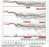
This is not a forecast, but the model output is start to show some signs of blocking and cold conditions for Sussex.

There is still a big spread past about 5 days, but at last this includes some very cold and potentially snowy outcomes...

GFS Worthing Ens 03-01-13 06Z.JPG

The snowfall % values go up to 25% later in the month, which is a good sign.

As I said, this isn't a forecast, but with a SSW underway, we may see a move to a more blocked scenario, which would start to appear (as above) as possible ensemble outcomes. What I'd be looking to see is more support for this, and closer agreement. As the 'non' event in December proves, we would need a cold outbreak to be within the 2 to 3 day range to feel confident of it occurring.


chucky1973

New member
Nov 3, 2010
8,829
Crawley
the bbc monthley report also suggest that towards the end of the month we may see some white stuff


Papa Lazarou

Living in a De Zerbi wonderland
Jul 7, 2003
19,185
Worthing
the bbc monthley report also suggest that towards the end of the month we may see some white stuff

Just heard that the internal Met Office guidance (issued at 2pm) is for an increasing signal for blocking and cold conditions, but there is still a lot of uncertainty.

I'd expect this to be reflected in the public forecasts soon, and hopefully the model output will reflect it also.


chucky1973

New member
Nov 3, 2010
8,829
Crawley
Just heard that the internal Met Office guidance (issued at 2pm) is for an increasing signal for blocking and cold conditions, but there is still a lot of uncertainty.

I'd expect this to be reflected in the public forecasts soon, and hopefully the model output will reflect it also.

in a nut shell does that mean snow?


D

Deleted member 18477

Guest
Snow would only make January even more depressing. Fortunately I can work from home but not ideal for those who have to make the time up or struggle into work. Plus it can effect the football schedule and seeing as we only have 1 midweek game at home between now and the end of the season... The snow can f*** off until December. December is good. Jan and feb are shit!


Giraffe

VERY part time moderator
Helpful Moderator
NSC Patron
Aug 8, 2005
26,946
2012 was officially the worst snow year since this thread was created.

2013 needs to do a lot to make up for it. Where is the white stuff???


Papa Lazarou

Living in a De Zerbi wonderland
Jul 7, 2003
19,185
Worthing
2012 was officially the worst snow year since this thread was created.

2013 needs to do a lot to make up for it. Where is the white stuff???

2012 was an awful year weather wide all-round. Perpetual Autumn.

There's still an increasing signal for high latitude blocking (to our North) later in the month. The GFS and ECM ensembles both show it to an extent, but there still a long way to go before this potential becomes snow flakes over Sussex.

As always, if there are any significant developments myself and other interested posters will update in here.


Papa Lazarou

Living in a De Zerbi wonderland
Jul 7, 2003
19,185
Worthing
To illustrate the potential here's a composite of the most recent GFS output. I've combined the 2m temp (surface temp, basically) with the 850hpa temp (temp at altitude, so basically how cold the airmass is) and the rainfall and snow potential; so it's all on 1 page.

I've marked the periods where there is support for snow down here. As you can see there are 2 period where we currently have 15% support for snow for a 2-4 day spell. As there is a lot of scatter, I'd expect this to either 'firm up' and increase (as the model output moves to support this solution) or it to fade away as the less cold (or drier) options are favoured.

GFS Worthing Ens Composite marked 04-01-13 06Z.JPG


Ⓩ-Ⓐ-Ⓜ-Ⓞ-Ⓡ-Ⓐ

Hove / Παρος
Apr 7, 2006
6,705
Hove / Παρος
I'm currently sitting in the departure lounge at Athens El Venezilos Airport, having enjoyed a sunny and warm few weeks in Greece with temperatures of around 15-17C. The white stuff can bugger off for all I care! Papa, are there any signs of a period of unseasonably WARM weather coming up? :)


Papa Lazarou

Living in a De Zerbi wonderland
Jul 7, 2003
19,185
Worthing
Ⓩ-Ⓐ-Ⓜ-Ⓞ-Ⓡ-Ⓐ;5408850 said:
I'm currently sitting in the departure lounge at Athens El Venezilos Airport, having enjoyed a sunny and warm few weeks in Greece with temperatures of around 15-17C. The white stuff can bugger off for all I care! Papa, are there any signs of a period of unseasonably WARM weather coming up? :)

It's currently above average, but will be returning to average by next week. After that it could be below average.


Uncle Spielberg

Well-known member
Jul 6, 2003
43,033
Lancing
4 weeks ago " the harshest winter for 100 years, -30 C, heavy snowfalls, snow several feet deep " in reality it has been very wet and very mild with south westerlies for 4 weeks with no end in sight. Another wet and very mild one.


Papa Lazarou

Living in a De Zerbi wonderland
Jul 7, 2003
19,185
Worthing
4 weeks ago " the harshest winter for 100 years, -30 C, heavy snowfalls, snow several feet deep " in reality it has been very wet and very mild with south westerlies for 4 weeks with no end in sight. Another wet and very mild one.

It was only the likes of the daily express that said that. The Met Office were always sceptical about the mid December cold spell that never was. Quite counter intuitively December came in pretty much spot on average in terms of CET, with a cold start offsetting the mild finish.

With the SSW kicking in, and further pulses due, the conditions for cold weather are more favourable now than in December.


Albion and Premier League latest from Sky Sports


Top
Link Here