You are using an out of date browser. It may not display this or other websites correctly.
You should upgrade or use an alternative browser.
You should upgrade or use an alternative browser.
Brighton picture quiz
- Thread starter The Large One
- Start date
More options
Who Replied?How did you get that from that picture
Bit of a lucky guess but, the area looked relatively flat so I guessed the park could be the Level and the trees looked about right.
I think the Lamb & Flag sign was a bit of a giveaway...
Next, who occupies this site now?

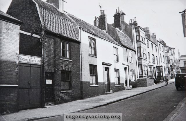
Is that Ship Street? Reminds me of that posh dentist building near HdeV.
Man of Harveys
Well-known member
the Pub du Vin? Formerly the Sussex Arts Club?
The Large One
Who's Next?
- Thread starter
- #545
the Pub du Vin? Formerly the Sussex Arts Club?
Correctamundo.
Hunting 784561
New member
- Jul 8, 2003
- 3,651
Is it Kensington Place/Trafalgar street? Originally struck me that it could be Tidy Street or similar. Defo has a North Laine feel to it.
Hunting 784561
New member
- Jul 8, 2003
- 3,651
Is it Kensington Place/Trafalgar street? Originally struck me that it could be Tidy Street or similar. Defo has a North Laine feel to it.
No Sir
Hunting 784561
New member
- Jul 8, 2003
- 3,651
OK - another clue.
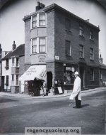
The road junction shown is now twice the size, carries a huge amount of traffic, but is not in the City centre
The road junction shown is now twice the size, carries a huge amount of traffic, but is not in the City centre
Hunting 784561
New member
- Jul 8, 2003
- 3,651
Elm Grove/Lewes Road
further out still...
Southover Street Seagull
Well-known member
OK - another clue.
The road junction shown is now twice the size, carries a huge amount of traffic, but is not in the City centre
Edward Street / Upper Rock Gardens?
Hunting 784561
New member
- Jul 8, 2003
- 3,651
further out from the centre again
clue - the road junction is now a major crossroads
clue - the road junction is now a major crossroads
The Large One
Who's Next?
- Thread starter
- #554
Warren Road / Falmer Road?
Rottingdean? Or along the coast road?
Hunting 784561
New member
- Jul 8, 2003
- 3,651
sort of right direction and distance from the centre
try again...
try again...
Southover Street Seagull
Well-known member
I thought it was Bear Road, but showing the wall, in shadow, from the other side, where the Crematorium is situated.
Now seeing as reading this thread has been responsible for burning two rashers of bacon and nearly burning two baguettes, I have have a question.
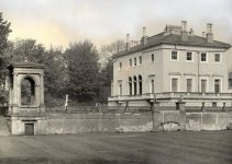
In Queens park, walking from Tower Road, in the Dog Zone you can see a sunken set of bricks. They cover three sides of a square, and had a path to them on the 1911 Ordnance Survey map, which the Local Studies part of the Library have. Does anyone know what this building was?
Are you walking down towards the park or up towards the Pepper Pot?
If you are walking down and are talking about the bushes and trees on your left after the junction of Tower Road and Attree Drive; they are part of the remains of Attree Villa I think.
Garden Temple, Attree Villa, Queens Park, Brighton:: OS grid TQ3204 :: Geograph Britain and Ireland - photograph every grid square!
http://www.mybrightonandhove.org.uk/page_id__8547_path__0p115p203p818p.aspx
Attachments
Hunting 784561
New member
- Jul 8, 2003
- 3,651
Rottingdean? Or along the coast road?
Yup its Rottingdean crossroads in 1934, looking north up the High Street
OK - a real toughie (if you don't cheat). Where is this road?


The Large One
Who's Next?
- Thread starter
- #560
Kingswood Street?


