Theatre of Trees
Well-known member

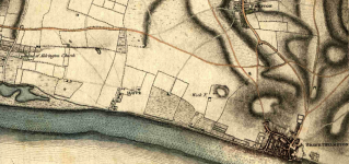
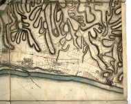
Taken from Yeakell & Gardner's map of Sussex that was surveyed between 1778-1783
The full map can be found here:
http://www.envf.port.ac.uk/geo/research/historical/webmap/sussexmap/Yeakell_36.htm

View attachment 124133
Taken from Yeakell & Gardner's map of Sussex that was surveyed between 1778-1783
The full map can be found here:
http://www.envf.port.ac.uk/geo/research/historical/webmap/sussexmap/Yeakell_36.htm
That map is incredible.
I believe this is the earliest "map" of Brighton, but isn't really a map so much as an illustration of the French attacking in 1514:
View attachment 124146
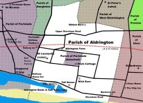
If anyone was wondering about the "ruins of Aldrington Church" - interesting history here https://en.wikipedia.org/wiki/St_Leonard's_Church,_Aldrington


That map is incredible.
I believe this is the earliest "map" of Brighton, but isn't really a map so much as an illustration of the French attacking in 1514:
View attachment 124146
Great find. I never knew that the French attacked Brighton and there's a small piece in the link that describes the event:
https://brightonmuseums.org.uk/discover/2014/06/06/brightons-first-map-the-french-attack-of-1514/
It tells of the attack and Sussex archers giving the French commander a 'King Harold' "Ouch".
It also explains why I could never work out why there's no longer a South Street to go with East, West and North.
I note that even then the traffic was awful