Is 3 snowflakes heavy snow on the back edge or does that denote sleet?
All to do with timing of the front and cold air sinking south at the right time to undercut it.
Don't think the cold will under cut quick enough, but looking at the 06z GFS run, it's looking very interesting from the following weekend onwards (long way out yet).
C'mon. Read the script. All we're going to get is SW'lys until March. No chance of any snow this year at all

Has the Daily Express favoured us with its forecast yet?
Blue sky and mild here.


No snow due for sussex, just cold crisp days and frosty nights for a couple of weeks before the SW return
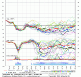
Accepting we cannot be sure and nothing imminently due for Sussex in terms of snow, but although there is a colder northerly drag within a reliable timeframe and some longer term colder evolution outside of a reliable timeframe, where is this return of SW's after a couple of weeks within the current data ??
No snow due for sussex, just cold crisp days and frosty nights for a couple of weeks before the SW return
The thing with those netweather forums - they're always talking about stuff around '9 days away'.
When the cold stuff doesn't arrive - they're not bothered, they're simply off and talking about the blizzard due 'in 9 days time'
I have a quick dip into them to get a quick overview then refer to papa here for some sense.
If I want someone to say it'll be SW's for the next 100 years - I search out some US posts
Outlook for the UK over the next 6-30 days
UK Outlook for Wednesday 4 Jan 2017 to Friday 13 Jan 2017:
Wednesday will be mostly cloudy across the UK, with patchy light rain and drizzle at times, mainly over hills and coasts in the north and west, whilst mostly dry elsewhere. Rain will be moving south-eastwards on Thursday, introducing brighter and colder conditions, with some wintry showers across the far north, these extending southwards. A colder north to north-easterly is likely to become established from Friday onwards, with frequent wintry showers across northern and eastern parts of the UK, particularly down the North Sea coasts. However, there will be a good deal of dry and sunny weather elsewhere. Some cold and clear nights, with widespread frost and the risk of icy patches. Some cloudier, milder interludes are possible at times, particularly in the west. Temperatures generally below the average throughout.
Updated at: 1302 on Fri 30 Dec 2016
UK Outlook for Saturday 14 Jan 2017 to Saturday 28 Jan 2017:
Latest suggestions favour a continuation of a very 'blocked' pattern, with drier and colder than normal conditions across the UK, and an increasing risk of fog and frost. However, we are likely to see brief, milder and wetter conditions at times. Generally, temperatures are expected to be below the average. There is a low risk of very cold conditions developing should the 'blocked' pattern persist, allowing a colder easterly flow to become established, with associated threat of snow in places.
Updated at: 1302 on Fri 30 Dec 2016

