Got something to say or just want fewer pesky ads? Join us... 😊

[Misc] The Award-winning official "More Snow Tomorrow?" Thread [2024-25 Season]


Uncle Spielberg

Well-known member
Jul 6, 2003
43,096
Lancing
About 1 cm of snow in Newhaven and looks like an inch over the downs so I guess I am now " owned " Still tonight I am sure will be rain with a possibility of snow over the highest downs


Papa Lazarou

Living in a De Zerbi wonderland
Jul 7, 2003
19,361
Worthing
About 1 cm of snow in Newhaven and looks like an inch over the downs so I guess I am now " owned " Still tonight I am sure will be rain with a possibility of snow over the highest downs

The snow this morning was very 'lucky' - the showers came onto the coast at just the right time (early hours) when air temps were as low as they could be (-1C to -2C) , and there was no onshore breeze either - so in the marginal situation everything was just right. 2 hours later and it would have been sleet for most.


Uncle Spielberg

Well-known member
Jul 6, 2003
43,096
Lancing
Snowing in Newhaven


Cheshire Cat

The most curious thing..
Depending on where in Cheshire you are, the next couple of days could see snow for you. This is the latest GFS ensemble for your area. High snow percentages.

View attachment 61885

Note, this is for Cheshire not Sussex
It started snowing here about one hour ago - not much so far but definitely white flakey stuff.


Giraffe

VERY part time moderator
Helpful Moderator
NSC Patron
Aug 8, 2005
27,229
Surprising chance of snow end of next week?


Papa Lazarou

Living in a De Zerbi wonderland
Jul 7, 2003
19,361
Worthing
Surprising chance of snow end of next week?
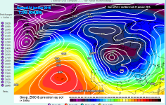
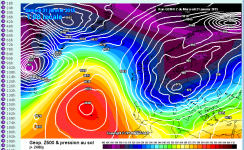
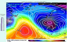
Ok, having looked at a few models, there is some agreement for a repeat of what we've seen pre-Xmas and this last week; with the Azores High relenting slightly, allowing low pressure to slide SE over the UK, introducing a seemingly temporary NW then N wind.

This is the ECM at 240 hours, so right at the end of it's range:

ECM 240 21-01-15.png

And this is the GFS Operational at the same time:

GFS 240 21-01-15.png

Finally GEM shows the same:

GEM 240 21-01-15.png

As we've seen, this is never great for down here, and where the ECM / GFS / GEM show this the upper temperatures are currently shown to be rather disappointing for Sussex snow.

What we need is the Azores High to ridge over the Low as it slides into Europe, and create a block over Scandinavia, but for the moment, the Atlantic is too vigorous to allow this, as the next low pressure reaches our shores too soon to allow the ridge time to develop.

Without that we won't get either a ridge north to Greenland or NE to Scandi. We need a short lull to allow this.


Yoda

English & European
Ok, having looked at a few models, there is some agreement for a repeat of what we've seen pre-Xmas and this last week; with the Azores High relenting slightly, allowing low pressure to slide SE over the UK, introducing a seemingly temporary NW then N wind.

This is the ECM at 240 hours, so right at the end of it's range:

View attachment 62044

And this is the GFS Operational at the same time:

View attachment 62045

Finally GEM shows the same:

View attachment 62046

As we've seen, this is never great for down here, and where the ECM / GFS / GEM show this the upper temperatures are currently shown to be rather disappointing for Sussex snow.

I noticed that on the 12z GFS run yesterday, needless to say the 18z had a DEEP low centred right over us tracking west to east.


Albion and Premier League latest from Sky Sports


Top
Link Here