Got something to say or just want fewer pesky ads? Join us... 😊

[News] Anyone remember the flooding in Chichester over the a27?


Dave the OAP

Well-known member
Jul 5, 2003
46,761
at home
It was a few years ago now and caused mayhem on the A27 and all the area around it. By the lake opposite the retail park!

Drove down to see Laura ( BAG) last weekend in Salisbury and couldn’t believe they have put up a huge housing estate exactly where the lake flooded to to the south of the A27.

Couple of points...surely any surveyor / solicitor worth his/her salt would find out that area has flooded and if so how will anyone get a mortgage on these properties, and also how would anyone sell the properties if it floods again.

I know we have to build houses, but this is a known flood area.


Biscuit Barrel

Well-known member
Jan 28, 2014
2,757
Southwick
After the floods they improved the flood defence system around the city.

Westbourne House lake is used to take the excess water when the river bursts its banks and stops the water from flooding the surrounding area.

I maybe wrong, but I can't remember the last time it flooded.


Blue3

Well-known member
Jan 27, 2014
5,835
Lancing
Not going very well for Italy this week as we have to blame the Romans for building Chichester on a flood plain in the first place


studio150

Well-known member
Jul 30, 2011
30,228
On the Border
Far too many homes being built on flood plains but just as normal homes without taking into account the probable flooding.
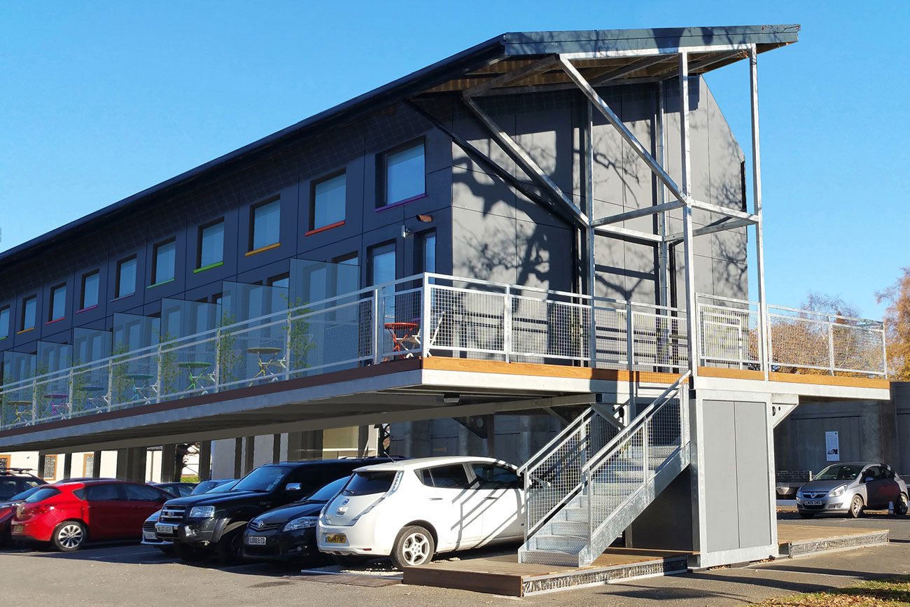
At least in York which floods frequently it would seem that commercial premises are being adapted so that parking is ground floor so that flooding doesn't destroy the offices and work areas. This type of design should be built into homes where they are building on known flood areas.


Dick Head

⭐⭐⭐⭐⭐
Jan 3, 2010
13,890
Quaxxann
Chichester in 2030.

zedpods-houses-over-car-park-1300x867.jpg


All those cars are at a meet-up for vintage car enthusiasts.


Bold Seagull

strong and stable with me, or...
Mar 18, 2010
30,464
Hove
All this building on flood plains...
1. The EA produce flood maps with flood zones indicating severity of potential flooding from 200 year events.
2. If any planning application is within a flood zone it has to be submitted with a Flood Risk Assessment (FRA).
3. The FRA will take data from a worse case 200yr event, adding allowance for global warming, that you then add say 600mm to to establish your habitable flood level.

This has been happening for at least 15-20years. I’m not sure how many newer developments have been flooding or not?


abc

Well-known member
Jan 6, 2007
1,389
It was a few years ago now and caused mayhem on the A27 and all the area around it. By the lake opposite the retail park!

Drove down to see Laura ( BAG) last weekend in Salisbury and couldn’t believe they have put up a huge housing estate exactly where the lake flooded to to the south of the A27.

Couple of points...surely any surveyor / solicitor worth his/her salt would find out that area has flooded and if so how will anyone get a mortgage on these properties, and also how would anyone sell the properties if it floods again.

I know we have to build houses, but this is a known flood area.
I remember it well as I was involved in the relief work. The river Lavant was deliberately diverted to flood other areas in order to protect Chichester, the problem being that the river goes under the city through roman culverts. A flood diversion scheme now takes excess river water around the city and down to Pagham harbour.

So in fairness, none of the new housing is being built on a flood plain or at risk. But calling the big scheme ‘Shopwhyke LAKES’ is rather ironic!


Bold Seagull

strong and stable with me, or...
Mar 18, 2010
30,464
Hove
At the time I was working nights in Chi and the lasting memory for me is the size of the rats running around the delivery yard having been flooded out of the culverts. The first one I saw was as big as an eight or nine week old kitten.

Sounds like a good time to be reading a James Herbert novel...


Stat Brother

Well-known member
NSC Patron
Jul 11, 2003
73,888
West west west Sussex
All this building on flood plains...
1. The EA produce flood maps with flood zones indicating severity of potential flooding from 200 year events.
2. If any planning application is within a flood zone it has to be submitted with a Flood Risk Assessment (FRA).
3. The FRA will take data from a worse case 200yr event, adding allowance for global warming, that you then add say 600mm to to establish your habitable flood level.

This has been happening for at least 15-20years. I’m not sure how many newer developments have been flooding or not?

This.

Shirley the point is you have to remember the floods of 20 years ago, not 20 hours!!


As for the 1 massive estate
The OP should be grateful they didn't drive along the A259, instead.

He'd be amazed to see 5 (five) massive estates in the 6 mile stretch from Angering to Bognor.


Timbo

Well-known member
Jul 5, 2003
4,322
Hassocks
All this building on flood plains...
1. The EA produce flood maps with flood zones indicating severity of potential flooding from 200 year events.
2. If any planning application is within a flood zone it has to be submitted with a Flood Risk Assessment (FRA).
3. The FRA will take data from a worse case 200yr event, adding allowance for global warming, that you then add say 600mm to to establish your habitable flood level.

This has been happening for at least 15-20years. I’m not sure how many newer developments have been flooding or not?

The issue is groundwater. New floods will appear a few miles away where it backs up as the groundwater can no longer move just below the surface as it does before you put up a new development.


carlzeiss

Well-known member
May 19, 2009
6,236
Amazonia
Can recall the Argus having a photo of a windsurfer on the A27 between Arundel and Chichester the last time the area flooded .


BLOCK F

Well-known member
Feb 26, 2009
6,723
I remember it well as I was involved in the relief work. The river Lavant was deliberately diverted to flood other areas in order to protect Chichester, the problem being that the river goes under the city through roman culverts. A flood diversion scheme now takes excess river water around the city and down to Pagham harbour.

So in fairness, none of the new housing is being built on a flood plain or at risk. But calling the big scheme ‘Shopwhyke LAKES’ is rather ironic!

Back in 1994 it was, and I also remember it well.
We've had no problems since, so a job well done, abc!:thumbsup:


kevsbha

New member
Sep 29, 2019
18
Remember driving over the bridge the army put up between bognor and Chichester at Oving took about 45 minutes for a 10 min journey back then. Now at rush hour it's like an hour to do the 7 miles


Albion and Premier League latest from Sky Sports


Top
Link Here